

Mingus Traverse
The Mingus Traverse offers a condensed adventure through the most iconic sections of the Cocodona 250 course. Starting in Prescott and finishing in Sedona, the route weaves through Prescott Valley, Mingus Mountain, Jerome and Clarkdale, showcasing Arizona’s rugged beauty.
*Distances may vary slightly each year due to permitting.

|
Race
|
||||
| Until 8/31/2026 | Until 2/28/2027 | Until 4/25/27* |
Walk-Up Registration
|
|
| Cocodona 250 | $1,995 | $2,045 | $2,095 | n/a |
| Sedona Canyons 125 | $695 | $735 | $775 | n/a |
| Bradshaw Brute 100 | $495 | $525 | $555 | n/a |
| Mingus Traverse 80 | $395 | $425 | $455 | n/a |
| Flagstaff Crest 40 | $195 | $215 | $235 | $235 |
Prices don't include AZ State & Yavapai County taxes (6.35%) or UltraSignup registration fees.
*Runners registering after 4/15 aren't guaranteed their name on bibs, race shirts, and other race goodies.
Event Location
Start
Watson Lake Park
3101 Watson Lake Park Rd
Prescott, AZ 86301
Finish
Sedona Ranger Station
250 Brewer Rd
Sedona, AZ 86336
Event Timeline
Sunday May 2nd, 2027
7:00 PM
Race Briefing / Q&A .
Highly recommended but not mandatory.
(Same location).
Monday May 3rd, 2027
6:00 AM
Mass start of race
Wednesday, May 5th, 2027
2:45 AM
Overall Race Cutoff
Time Limit
44.75 Hours
Bib Pickup
Option 1
Saturday May 2, 2027
1:00 PM – 5:00 PM
Merch available, No Drop Bags except for the 250
(Deep Canyon Ranch, Black Canyon City)
Option 2 Fleet Feet Prescott
Sunday May 2nd, 2027
4:00 PM – 7:00 PM
No drop-bag drop off
Course Information

Date | Monday May 3, 2027 - Wednesday, May 5, 2027
Start Time | 6:00 am
Time Limit | 44.75 Hours (2:45am on May 7th)
Distance | 79.8 Miles
Total Estimated Elevation Gain + Loss | Gain: 10,002 + Loss: 11,027 feet (2026)
World Class Trail Systems | Prescott Circle Trail, Dead Horse State Park, Sedona
Journey Through Mainstreet | Jerome, Clarkdale & Sedona

Total Estimated Elevation Gain | 10,002′ (2026)
Total Estimated Elevation Loss | 11,027′ (2026)
Max Elevation | 7,819 feet
Min Elevation | 3,319 feet
Aid Stations | 6 Aid Stations and 1 Water Station
Aid stations will all have water, an electrolyte drink, sodas, sweet snacks, salty snacks, and fruit. All aid stations will also have vegetarian and vegan options. GF can be made upon request - please ask. Most aid stations will also have a substantial hot meal.


From sweeping desert vistas to Sedona’s breathtaking terrain, this race delivers an unforgettable journey and a true test of endurance for any athlete.
UPDATED 2026 detailed course descriptions can be found here.


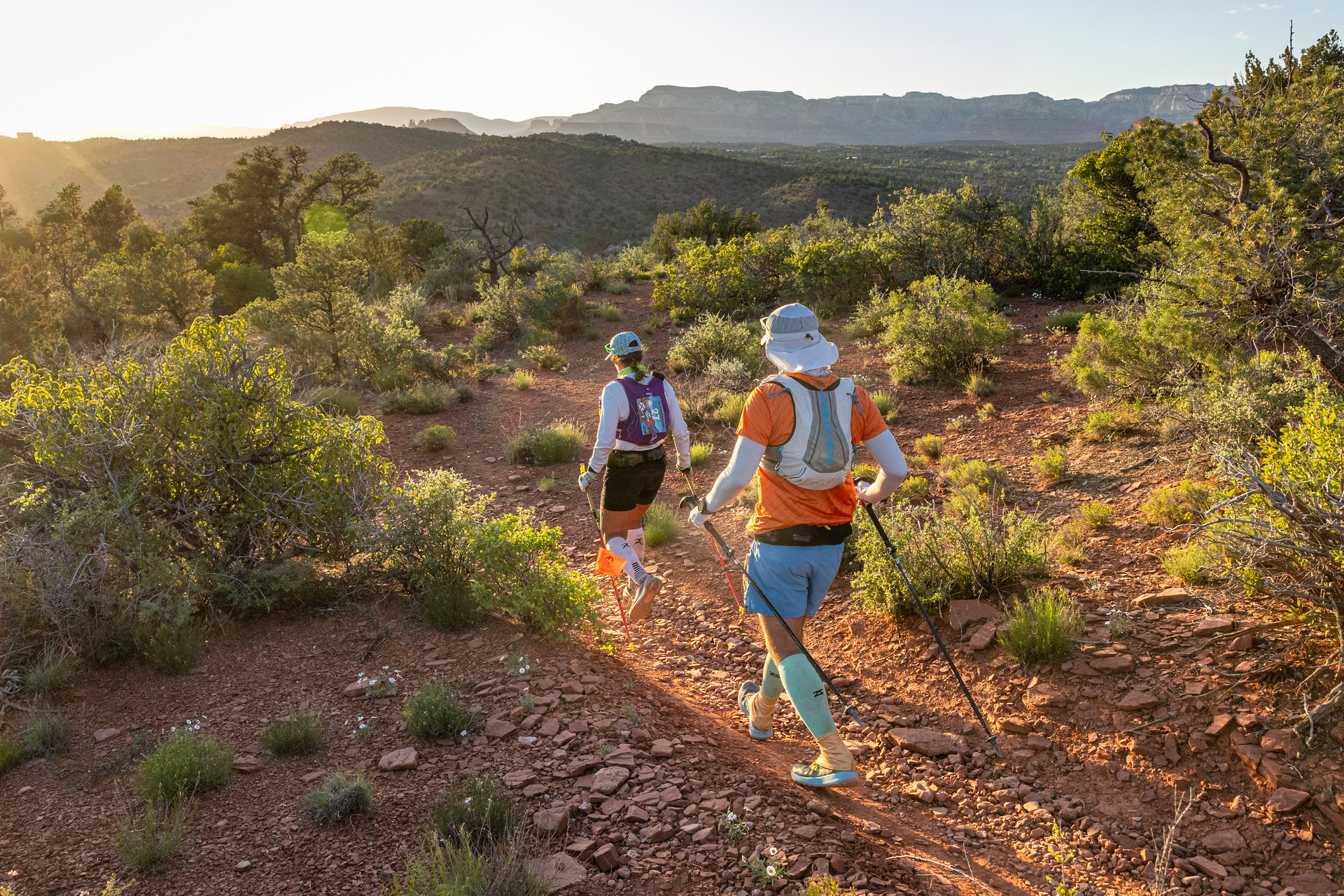
The Mingus Traverse 82 offers the experience of a lifetime, taking runners on an 82-mile journey through the most scenic lands in Central Arizona. Connecting multiple geographic zones, historic towns, and vibrant communities, this race highlights the best of what Arizona has to offer.
This point-to-point adventure links Prescott, Prescott Valley, Mingus Mountain, Jerome, Clarkdale, and Sedona in what can only be described as an unforgettable test of endurance and resilience.
The route celebrates not only some of the most iconic trail locations in Arizona but also its rich history, diverse landscapes, and the spirit of its people.


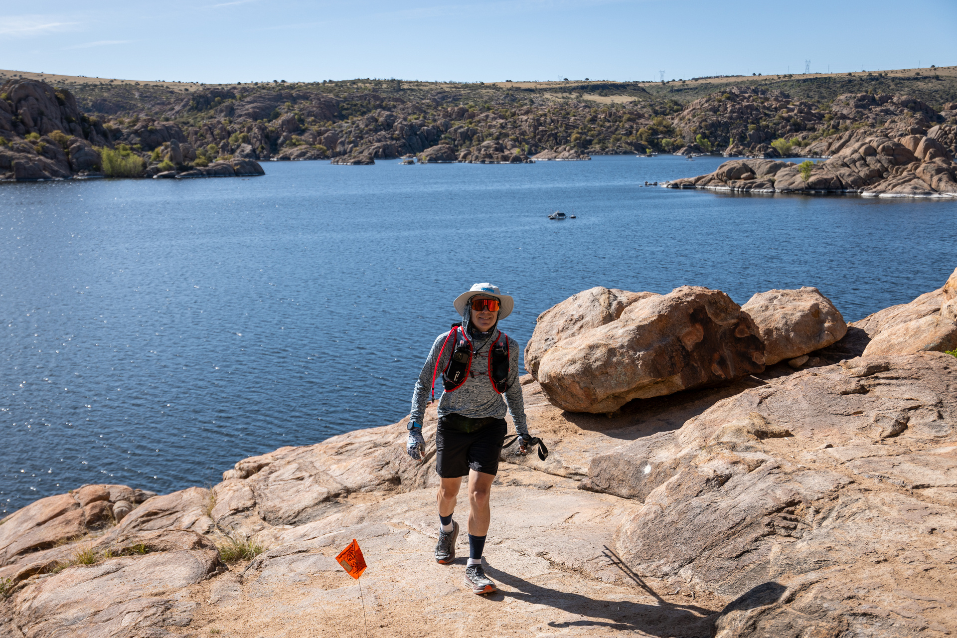
Descending from the Bradshaws and on route to Mingus Mountain, the route crosses the Prescott Valley, an extremely diverse landscape containing Ponderosa pine forests, desert grasslands, lakes, and the unique Granite Dell rock formations.
But first, runners will head directly into downtown Prescott and a Major Aid Station on the infamous Whiskey Row, also the first place runners can pick up pacers. This was the first capital of the Arizona Territory dating back to 1864 and the epicenter of Arizona mining history, not to mention a great place for a shot of whiskey. After a few miles of pavement to stretch the legs, the course skirts Watson Lake and navigates the rocks of Granite Dells before hopping onto the Iron King Trail at mile 85.


Leaving Prescott, runners will cross through some high desert grasslands, Prescott Valley and the Fain Cattle Ranch lands on their way to Mingus Mountain. Antelope herds are frequently seen bounding across this vast ranchland. Runners will celebrate the 100 mile mark with a fist pump just after leaving the Fain Ranch Aid Station.


Stretching diagonally across Central Arizona, the Black Hills rise up to almost 8000 feet and separate the Prescott Valley from the Verde Valley. Runners will climb single-track switchbacks up, up, up, and over the range to the top of Mingus Mountain.
The views from the top of Mingus, across the Verde Valley to the red rock walls of Sedona and the peaks of Flagstaff beyond are some of the most spectacular of the course. Fill your lungs with the view and then get ready for a technical decent on the North Mingus trail, eventually dropping you into the old mining town of Jerome.


A historic Town based upon mining, it is now an artists enclave and tourist stop. Runners will tour directly through the old town perched on the north side of the Black Hills at an elevation of 5,000 feet with sweeping views to the Northern parts of the course.


Through one of the only wine producing regions in Arizona, runners will hit the Clarkdale main square on their way to the Verde River. Wading across the cool Verde River at the midpoint of the course will be a great way to refresh the legs before a 40+ mile stretch of world-class single-track.
This stretch starts with Tuzigoot National Monument and then hits the Aid Station in Dead Horse Ranch State Park before heading up the Lime Kiln Trail. Views go from great to amazing to bonkers as each crest feeds you more of the red rock vistas to come in Sedona.


Red rock country and one of the most iconic landscapes in the United States, Sedona’s beauty is beyond description. Runners will have plenty of time to soak up the views from every vantage point in the valley as the course traverses the entire valley under the big red walls and through the heart of the town.
At the end of this magical loop, the course leaves the valley and starts a massive climb up the Casner Canyon Trail. Once on top of the plateau, the route looks back on the beauty below in the Sedona valley. No doubt, a tear will be shed for the burning quads, whipping wind, and/or sheer beauty of the drop-off to either side.

Sunday, May 3rd, 2026
1:00 PM – 5:00 PM: Cocodona250 Race check-in and drop-bag drop-off at Start Line (Deep Canyon Ranch, 18600 E Deep Canyon Trail, Black Canyon City, AZ).
- Aravaipa and Cocodona specific merchandise available for purchase.
- Food trucks onsite.
DRIVE 15 MPH IN DEEP CANYON RANCH.
5:30 PM: Cocodona250 and Bradshaw Brute 100 Race Briefing / Q&A. Start Line (Deep Canyon Ranch, 18600 E Deep Canyon Trail, Black Canyon City, AZ).
- Food trucks onsite.
- Highly recommended but not mandatory.
- A pre-recorded race info session will be available prior to race week for those not able to attend.
Monday, May 4th, 2026
3:45 AM – 4:45 AM: Cocodona250 4-liter capacity check & SPOT Trackers issued. Deep Canyon Ranch.
- Drop bag drop-off for Cocodona 250.
- Food/Coffee trucks onsite.
Race morning packet pickup NOT available.
DRIVE 15 MPH IN DEEP CANYON RANCH.
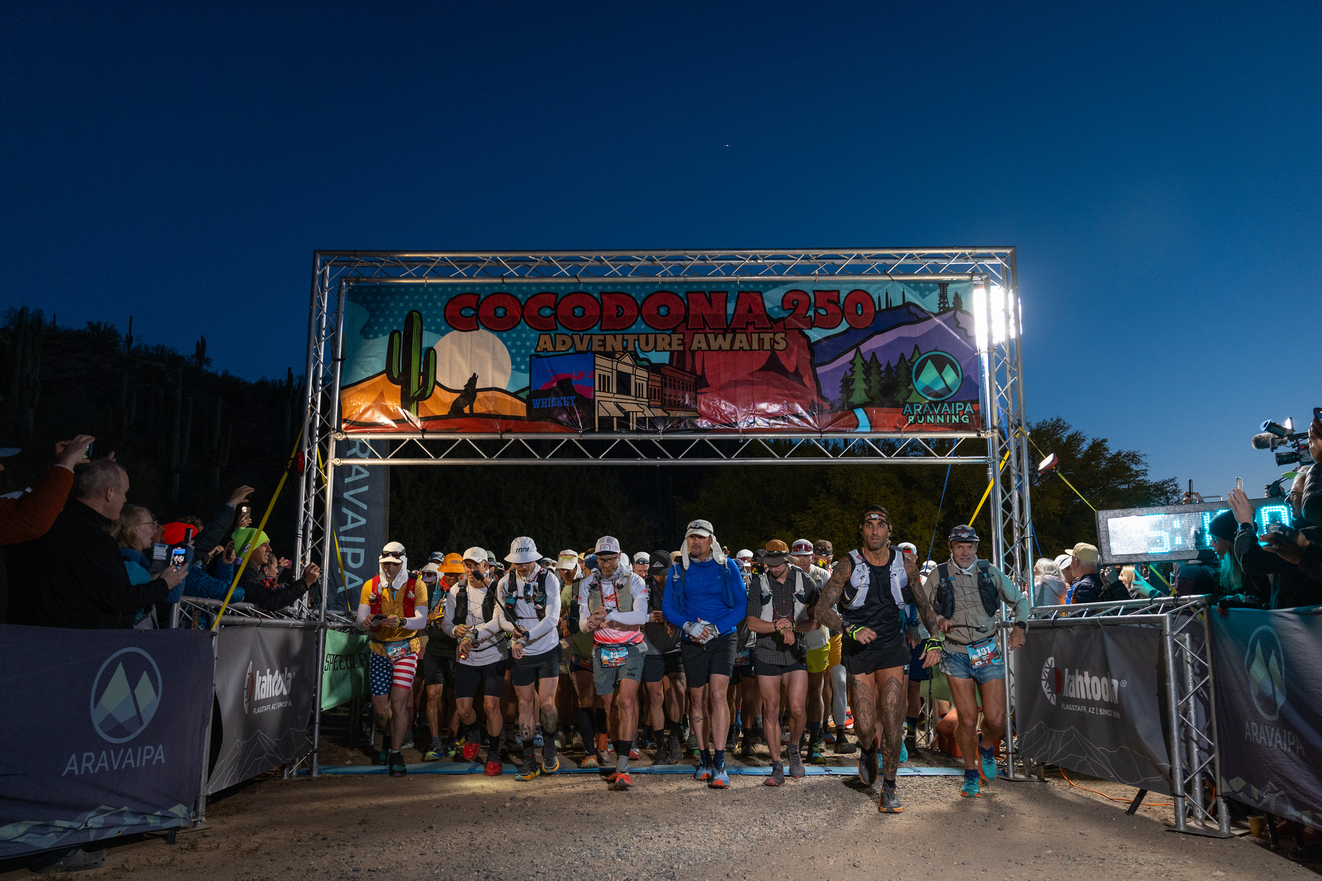
5:00 AM: Cocodona250 Race start in mass.
5:05 AM – 5:45 AM: Bradshaw Brute 100 4-liter capacity check & SPOT Trackers issued. Deep Canyon Ranch.
- Drop bag drop-off for Bradshaw Brute 100.
- Food/Coffee trucks onsite.
- Race morning packet pick up NOT available.
DRIVE 15 MPH IN DEEP CANYON RANCH.
4:00 PM – 7:00 PM: Mingus Traverse 80 packet pickup and merch sales. Prescott.
- No drop bag drop-off.
- ONLY MT merch available.
7:00 PM: Mingus Traverse 80 Race Briefing / Q&A. Prescott (Location TBD).
- Highly recommended, but not mandatory.
- A pre-recorded race info session will be available prior to race week for those not able to attend.
Tuesday, May 5th, 2026
5:00 AM – 6:00 AM: Mingus Traverse 80 Drop bag drop off. Watson Lake Park, 3101 Watson Lake Rd.
- Race morning packet pick up NOT available.
6:00 AM: Mingus Traverse 80 Race start in mass. Watson Lake Park.
4:00 PM – 7:00 PM: Sedona Canyons 125 packet pickup and merch sales. Cottonwood (Location TBD).
- NO drop-bag drop-off.
7:00 PM: Sedona Canyons 125 Race Briefing / Q&A. Cottonwood (Location TBD).
- Highly recommended, but not mandatory.
- A pre-recorded race info session will be available prior to race week for those not able to attend.
Wednesday, May 6th, 2026
5:45 AM – 6:45 AM: Sedona Canyons 125 SPOT Trackers issued. Gold King Mine Ghost Town located at 1000 Perkinsville Rd in Jerome.
- Drop bag drop-off.
- Race morning packet pickup NOT available.
7:00 AM: Sedona Canyons 125 Race start in mass.
Thursday, May 7th, 2026
4:00 PM – 7:00 PM: Flagstaff Crest 40 packet pick-up, drop bag drop-off, and merch sales. Fort Tuthill County Park. 2446 Fort Tuthill Loop Road.
- Drop bag drop-off (you can also drop off your drop bags on race morning).
- Enter the park and follow signs for Flagstaff Adventure X Extreme. Park in the huge parking lot and walk towards the buildings on the Quad.
- A pre-recorded race info session will be available prior to race week.
Friday, May 9th, 2026
6:00 AM – 7:00 AM: Flagstaff Crest 40 drop bag drop-off. Fort Tuthill County Park.
- Race morning packet pickup NOT available.
7:00 AM: Flagstaff Crest 40 race start in mass. Fort Tuthill County Park located at 2446 Fort Tuthill Loop in Flagstaff.
10:00 AM – 10:00 PM: Aravaipa and Cocodona specific merchandise available for purchase at the finish at Heritage Square in Flagstaff.
Saturday, May 9th, 2026
6:00 AM – ???? (until 30 mins after last finisher): Aravaipa and Cocodona specific merchandise available for purchase at the finish at Heritage Square in Flagstaff.
??? AM (Typically between 7:00 AM – 10:00 AM): Last Cocodona 250 finisher celebration. Heritage Square in Flagstaff.
- Come spirit tunnel in the last finisher and see them receive the DFL award.
Race Info

During the race, it is MANDATORY to carry a gps enabled device with the course file downloaded. This device can be a handheld GPS unit, watch, or smartphone. The smartphone is the easiest and least expensive option.
To use a smartphone, install a mapping App such as Gaia, GuruMapsPro, TrailForks, Strava or AllTrails to your phone. Then download the course GPX file from CalTopo. Please find the CalTopo map in the yellow button in the 250 Mile Course Map on this webpage.
Protip – Place your phone in airplane mode to maximize battery life.

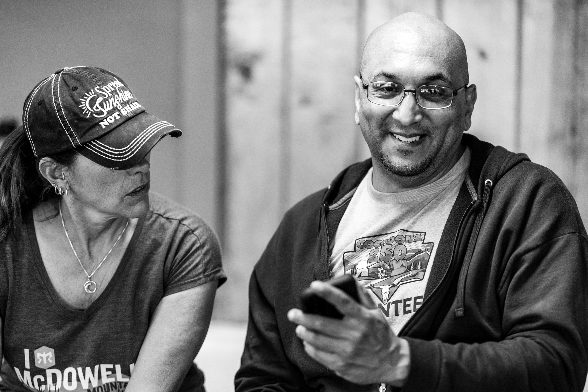
This race would not be possible without an incredible team of volunteers. Come help the dreams and goals of our runners become a reality on race day by volunteering. We have roles from aid station captains and volunteers, to course sweeps, to setup/breakdown, and more.
See the volunteer page for more info and a link to signup for a volunteer shift.

SCHOLARSHIPS APPLICATIONS ARE NO LONGER OPEN FOR 2026. Scholarship deadline will be 10/15/2025. Competing in the Cocodona250 is a life changing event. If you are not able to afford the Cocodona250 registration, will be ready to take on the physical challenge, and need something to do the first week of May, please fill out this google form.
Please email Assistant RD Erika at erika[@]aravaiparunning[dot]com with any questions about the scholarship.
If everyone could experience it, we feel the world would be a better place. But the barriers are high. Commitment, training time, logistics, crew, pacers, travel, and the determination needed to complete the race make this a big pill to swallow. Not to mention the large registration fee (it isn’t cheap to organize, we might add). Aravaipa and Kahtoola both extend the opportunity to one runner each who might not otherwise be able to afford the race entry for Cocodona250. Other scholarship spots may be available pending available funds. Selection will be made and announced on 10/30/25. If you would like to donate to our scholarship entry pool, you can do so HERE.


We are so lucky to make the outdoors our passion and we want to continue to keep the beautiful trails we enjoy clean and open for future use. We realize that an event of this magnitude has an environmental impact but Aravaipa has committed to minimizing that impact. To that end, Aravaipa will have recycling and Terracycling of wrappers at aid stations, will offset carbon footprint from staff travel, and the race will be cupless. We encourage runners to offset their own carbon footprint and we welcome any ideas you may have to increase the race’s environmental sustainability. Explore, enjoy, protect!
What does CUPLESS mean? There will be no paper cups for cold drinks at the aid stations. Runners will be responsible for carrying their own containers to refill along the way. Grab a cup, a hydration vest, pouch, or water bottle and we will fill it at each aid station along the way. We ask you to help us in our efforts by preparing for a cup-free race day and thank you in advance for being good stewards of the trail. We will provide hot cups for coffee, broth, and soup.
We have paired with Terracycle to help collect and recycle gel packets, energy bar wrappers, and other generally non-recyclable materials that we find every day in the running community. Look for our Terracycle containers at each aid station.


Thank you for your interest in Cocodona 250. This race is incredibly meaningful to myself and those at Aravaipa Running who have dreamed about a race of this magnitude for a while. It isn’t so much about the distance as it is about linking communities and people while exploring some of the best Arizona has to offer.
– Jamil Coury, Cocodona 250 Founder & Aravaipa Running Owner

Aid stations will all have water, an electrolyte drink, sodas, sweet snacks, salty snacks, and fruit. All aid stations will also have vegetarian and vegan options. GF available upon request - please ask. Most aid stations will also have a substantial hot meal.
Cocodona 250 – 21 aid stations and 4 water stations.
Sedona Canyons 125 – 10 aid stations and 2 water stations.
Bradshaw Brute - 7 aid stations and 2 water stations.
Mingus Traverse 80 - 6 aid stations and 1 water station.
Flagstaff Crest 40 – 4 aid stations.

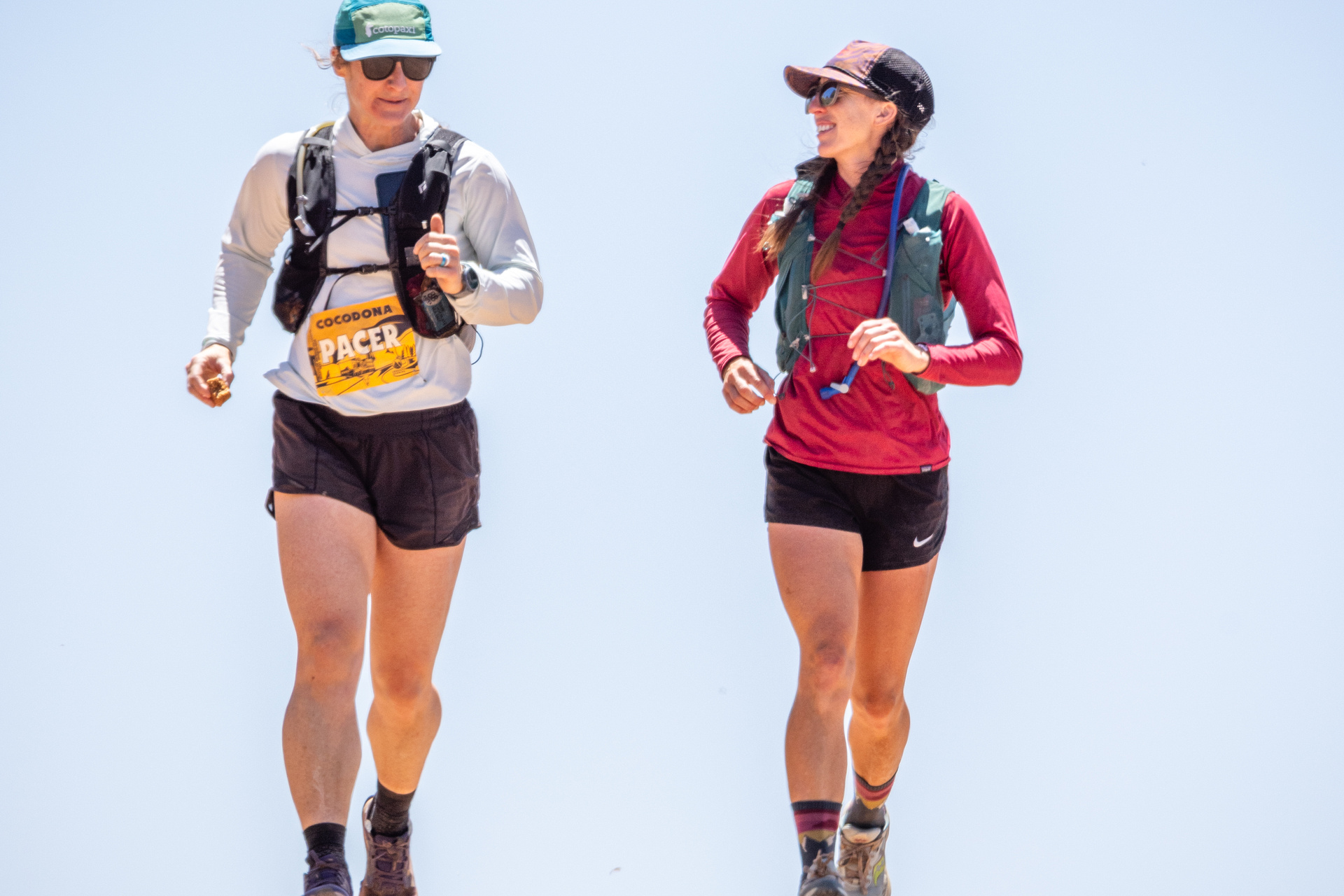
Pacers are to accompany their runner on foot (no bikes). Multiple pacers may be used, but only one at a time and must swap out at designated pacer access aid stations.
Pacers will need to sign a pacer waiver which will be available at each pacer-access aid station. Pacers will be provided with a pacer bib which must be worn and visible while out on the course. Checkout more info for pacers in the Crew and Pacer Guide.
*Pacers are not allowed for the Bradshaw Brute 100, Mingus Traverse 80 and Flagstaff Crest 40 mile races.

The course will be marked with orange plastic ribbons with black polka dots. Please pay attention to these signs at each junction. In addition, WRONG WAY flagging (blue & white checkerboard).
Although the course will be adequately marked, runners will be required to carry a GPS enabled device with the course file and are responsible for understanding the layout of the course. Please familiarize yourself with the course maps on our website prior to race day.

At Aravaipa Running, we want to create and ensure a space for every athlete, fostering inclusivity within our sport. It is important to us that all runners and participants are accepted and welcome at our events. In that respect, we have established the following Transgender & Non-Binary Policy.
Transgender Athletes – We will accept each entrant’s declared gender at face value. No additional supporting evidence is required.
Challenges of Results Involving Transgender Athletes – Aravaipa Running will not tolerate hateful or discriminatory behavior by any of our runners, or those associated with the race, regardless of the cause. Our commitment to inclusivity extends to fostering a culture of respect and understanding among all participants. We expect all parties to behave in a manner that is honest, compassionate, and respectful. Discriminatory behavior or challenges based on gender identity will not be tolerated or entertained.
Non-Binary Athletes – Non-binary and gender non-conforming athletes are encouraged to register as their self-identified gender. UltraSignup now offers a non-binary option for runners upon registration. We pass this option on to our runners when they register. If you have an existing account, you may need to edit your account to indicate your gender as non-binary.
Non-Binary Awards – Awards will be provided to the top-three Non-Binary athletes, alongside the Men’s top-three, Women’s top-three, and DFL awards.
Policy Review and Feedback – We are committed to ensuring this policy remains up-to-date and equitable. Your feedback is important to us. If you have questions, comments, or suggestions, please do not hesitate to email RD Steve at steve[@]aravaiparunning[dot]com.

Entry fees are non-refundable. A 75% UltraSignup credit of entry fees paid will be available until 60 days prior to event or 50% between 30-60 days. No race credits will be issued within 29 days of the event. Credits will be good for one year from date of issuance and can only be used once. If you withdraw from an event for which credits were used, you will not be reissued those credits. This reissuance policy also includes credits earned and used by volunteering. No cash refunds or transfers to another participant or event will be issued under any circumstance. No rollovers or transfers to next year. Withdrawals can be made directly in UltraSignup and the credits will be automatically credited to your account. Selling or transferring race entries is not permitted.
Whether planned or unplanned, an expected or unexpected start or end to a pregnancy, healing and recovery time are required for a woman’s overall health. Aravaipa is committed to being fair across the board…to everyone. Individuals who need a deferral due to these circumstances are eligible to receive 100% UltraSignup race credit, good for two years from date of issuance.
For merchandise or other add-ons (but not including the standard shirt or equivalent goodie), we will provide a 100% future race credit for the cost of the merchandise or other add-on in UltraSignup up until we order the items. These credits can only be used on race entry fees. After we place the order, we cannot provide any refunds or credits. Race shirts may only be picked up in person at packet pickup, we cannot mail out shirts to participants that do not attend the event.
We understand that issues arise at the last minute that can prevent a runner from arriving at the start line. We incur most costs early in the planning process, and this policy represents our ability to reasonably provide something to runners who cannot attend, while keeping our entry fees low and race quality high.
Cocodona links up some of the most diverse terrain that Arizona has to offer and it also runs through the most important historical towns in the State. Event founder Jamil Coury wanted to find a way to run from the outskirts of Phoenix to downtown Flagstaff – from the Sonoran Desert to the ponderosa pine forest of his home State while also incorporating some of Arizona’s oldest towns. The goal is to inspire not only those participating in this grand adventure on foot, but also the people who breathe life into these amazing communities the race traverses through.
The name Cocodona is derived from “Coconino”, the county and National Forest where the race ends and “Sedona” one of the most iconic towns surrounded by incredible red rocks we’ll traverse through.
2021 was the inaugural year for the event and we had 174 starters and 108 finishers (62% finish rate). Original course progressed west out of Sedona and up onto the Coconino Plateau via the Casner Mountain Grade.
2022 gave us the Crooks Fire and a major reroute (85 miles) of the course. The start line was changed to Prescott with a counterclockwise loop around town and an out-n-back to Skull Valley. Another out-n-back was added in the Munds Park area to keep the mileage up to 250. In addition to the route changes from the fire, we changed the course to leave Sedona to the east and climbed onto the Coconino Plateau via the Casner Canyon Trail. We had 220 starters and 151 finishers (69% finish rate).
2023 was the year we found our final home for the Cocodona course. No more major course changes to the 250 course. We also added the Sedona Canyons 125 and the Elden Crest 38 race distances to the event. We had 193 starters and 139 finishers (72% finish rate) for Cocodona, 65 starters and 52 finishers for Sedona Canyons, and 112 starters and 105 finishers for Elden Crest.
2024 saw no major reroutes for the Cocodona course. Although the 250 course stayed untouched, the Sedona Canyons 125 and Elden Crest 38 race distances saw significant course changes due to Forest Service permitting complications. We had 278 starters and 202 finishers (72%) for Cocodona, 197 starters and 142 finishers for Sedona Canyons, and 162 starters and 158 finishers for Elden Crest.
Films & Media
Results & Photos
New in 2025
New in 2025
2025 | Cocodona 250 by Run 200 Photos | Sedona Canyons | Mingus Traverse 78 | Flagstaff Crest 39
2024 | Cocodona 250 by Run 200 Photos | Sedona Canyons | Elden Crest 38
2023 | Cocodona 250 by Run 200 Photos | Sedona Canyons | Elden Crest 36
2022 | Cocodona 250 by Run 200 Photos
2021 | Cocodona 250 by Run 200 Photos

Thank you to our partners!


