2024 RUNNER GUIDE
January 20-21, 2024
100M | 100K | 60K | 40K | 10M | 5M
Estrella Mountain Regional Park, Goodyear, AZ
The Coldwater Rumble is the fifth race in the Aravaipa Running – Desert Runner Trail Series, Arizona’s premier trail & ultra run series.
Hummingbird Series = 5 Mile | Quail Series = 5 Mile | Roadrunner Series = 10 Mile | Owl Series = 40K
Hawk Series = 60K, 100K, 100 Mile
Quick Links: Race Info | Registration | Course Info | Results | Photos | Race Day
This race is part of a Series Pass! Check out some options HERE!
RACE INFORMATION
Location
Estrella Mountain Competitive Track
Estrella Mountain Regional Park, Goodyear, AZ. Directions
Course Summary
Follow desert trails that wind through the foothills of the rugged and jagged Sierra Estrella mountain range. Many trails at Estrella Mountain Regional Park have recently been re-worked and there are several new miles of trail in use for this course. The 100 mile race will feature two 10 mile (red) loops followed by three 27 mile (blue) loops. Runners will come through the start/finish a total of four times (after red 1, after red 2, after blue 1, after blue 2).
Weather
Forecast for Goodyear, AZ
Average highs for this time of the year are in the mid 60’s and lows in the low 40’s. While a storm and/or a cold snap does happen, expect beautiful running weather in the Valley of the Sun!
Host Hotel
TownPlace Suites by Marriott Phoenix/Goodyear
13971 Celebrate Life Way
Goodyear AZ 85338
Bib/Shirt Pickup
Friday, January 19 – 2:00PM – 6:00PM
Estrella Mountain Competitive Track
(602) 506-2930 ext. 6
*If you are only picking up your race packet, you will not need to pay the entry fee on Friday afternoon*
——————–
Saturday, January 20 – 6:00AM – 8:45AM
Estrella Mountain Competitive Track
Race Perks
Gender specific race shirt (Men’s & Women’s styles)
Chip timed race results displayed at finish line
Scenic and challenging course on desert trails
Well stocked aid stations
Post race food & socializing
Coldwater Rumble printed finisher glass or 100K Award from Aravaipa Artworx
100 Milers:
Buckles to 100 Mile Finishers under 32 hours
Sub 24 Hour buckle to 100 Mile Finishers under 24 hours
Cupless Events
In an effort to continually lessen our race footprint, we are continuing our cupless events in the Desert Runner Trail Series. We will have UltrAspire reusable cups available at registration and on race day or feel free to bring your own! Otherwise, there will be NO CUPS at aid stations for water, electrolyte drinks, soda, etc.
Crews & Pacers
Crews are welcome to support runners near the start/finish line located at the Competitive Track. This will serve as the “Rumble Headquarters” for the duration of the 32 hour event! Crew canopies are welcome along the course where the runners come through every lap.
Crews will also be allowed at Coldwater Ranch Aid, but structures cannot be set up, and there is no camping.
Pacers may join 100 Mile runners after mile 47 (last two Blue Loops).
Pacers may join 100K runners for their final Blue loop of the race.
There are no pacers allowed for any other distance.
Awards
Awards to the top 3 male & female finishers at each distance
Coldwater Rumble printed finisher glass for distances up to 60K
Points earned in the Desert Runner Trail Series (finale at Mesquite Canyon in March)
100K runners will receive a unique award from Aravaipa Artworx
Buckles to 100 mile finishers
Volunteer Helpers
If you would like to join our volunteer team, we are looking for help with event setup, aid station captains, aid station helpers, timing, photography, videography, social media, course sweep and event breakdown. Volunteer perks include a piece of Aravaipa merchandise or race goody and Aravaipa Race Credits. You can see our current opportunities and sign up here: Coldwater Rumble Volunteer Form
REGISTRATION
Entry Fees*
| Until 8/21 | Until 12/25 | Until 1/15 | Race Week | |
| 100 Mile | $300 | $320 | $340 | $360 |
| 100 KM | $170 | $185 | $200 | $210 |
| 60 KM | $130 | $145 | $160 | $170 |
| 40 KM | $90 | $105 | $120 | $130 |
| 10 Mile | $70 | $80 | $90 | $100 |
| 5 Mile | $45 | $50 | $55 | $60 |
Registration Options
Online via Ultra Signup
100 Mile Mail-in Entry
Other Distances Mail-in Entry
Camping & Tent Rentals
Online registration closes on Monday, 1/15, at 11:59 PM. Registration will be available after online registration closes at all packet pickup locations and race day as long as we have not reached our capacity.
Cut-Offs
All distances must LEAVE Rumble HQ Aid for their final loop by 6:15 AM on Sunday January 21. This is mile 73.3 for the 100 Mile and mile 36.7 for the 100K.
Cutoff for all races is 3:00 PM on Sunday (32 hours for 100 miler).
Medical – ![]()
We will have medical staff based at the start / finish headquarters. This team is here to help you with most basic and advanced first aid right on site. We reserve the right to pull you from the race if medical officials deem it necessary. Please understand that these decisions are made for your safety and do not argue. Continuing on in a state where you cannot safely navigate is a recipe for disaster and we are here to prevent that.
NOTE: If something happens to you or another runner, do NOT call 911 right away. Our medical team is highly trained in these scenarios, has been with us at this race the last three years and understands the terrain and driving access points. Please call their 24-hour number that will be answered by a real human being and they will dispatch accordingly.
MedStar Solutions Race Day Number: 480-269-4126
COURSE INFORMATION

Courses
All courses feature a wide variety of typical desert trail running surfaces including crushed granite single track, rocks, boulders, sandy washes, old jeep roads, and dry wash beds. Be prepared for a wide variety of conditions from very well defined, to more remote and sandy. Course Photos
The course itself sits at the foothills of the virtually untouched, rugged, mountain range known as the Sierra Estrella Mountains that will provide some gorgeous backdrops throughout your journey. I guarantee at some point during this race you’ll be drawn to these peaks. You will mostly be running on rolling single and double track trails without any real substantial climbing in one shot. There is a 1.5-2 mile section on the back half of the course named the Corgett Wash and can be very sandy depending on the weather leading up to the race. This is a great race to consider gaiters because of this.
Hiking/trekking poles are not quite as useful but are allowed.
A couple other points to consider with this race (more specifically 100M and 100K runners):
- Keep in mind that we can have some pretty dramatic temperature swings from day to night (30-40 degrees). You may be running through the day with a headwrap on to protect yourself from the heat (see: zero shade cover) and then bundling up to stay warm through the late parts of the night. I know, 40 degrees is nice where you’re coming from this time of year. Trust me, it’s a cold 40 degrees here and running in and out of the washes on course you’ll understand.
- As it is the middle of winter, there will be a long period of night time running. Do not get caught out on the trail between aid stations without a headlamp! Bring an extra and be prepared to run through the night from 6pm until after 7am. You will begin your race just as civil twilight hits the horizon so it’s possible to start your race sans headlamp but it’s your call- you’ll be on a trail 100 yards into the race.
- For those of you joining us after running the Javelina Jundred 100 miler in October, you’ll see there are two additional hours to finish for Coldwater. The terrain is more technical, the night longer, and we want you to finish this thing. Keep Going.
Course Maps
![]() 100 Mile: Red, Red, Blue, Blue, Blue
100 Mile: Red, Red, Blue, Blue, Blue
100K : Red, Blue, Blue
60K : Red, Blue

40K: Blue Loop with a more direct route from Dysart to Coldwater Ranch Aid

10 Mile (Red Loop)

5 Mile

GPS Files
100 Mile CalTopo 100 Mile Strava
100K CalTopo 100K Strava
60K CalTopo 60K Strava
40K CalTopo 40K Strava
10 Mile CalTopo 10 Mile Strava
5 Mile CalTopo 5 Mile Strava
CalTopo Review
Desktop: Top of the screen will have an “Export” drop down menu. Select from GPX, KML, etc. in the top left. Click Export.
Phone: On left side of screen there will be 4 icons. Click the folder with pin drop, then Export. On the top will be a drop down menu title “Format.” Set it to the file type you want and then click Export. The export will load, and if you have a tracking app on your phone already (Gaia for example), it should ask to export directly to your app. Once the export is complete, you can use this during your race in airplane mode and always know where you are.
NOTE: It is important to make sure you set the file format appropriately or the file will not download as a GPX or KML.
RACE DAY INFORMATION
Race Day Schedule
Please arrive early to park, check in and warm up prior to your run. Restroom facilities are located at the start line and Coldwater Aid Station as portable restrooms.
Timeline
Saturday, January 20, 2024
6:00 AM – Packet pickup / race day registration begin
6:55 AM – 100 Mile Race Briefing
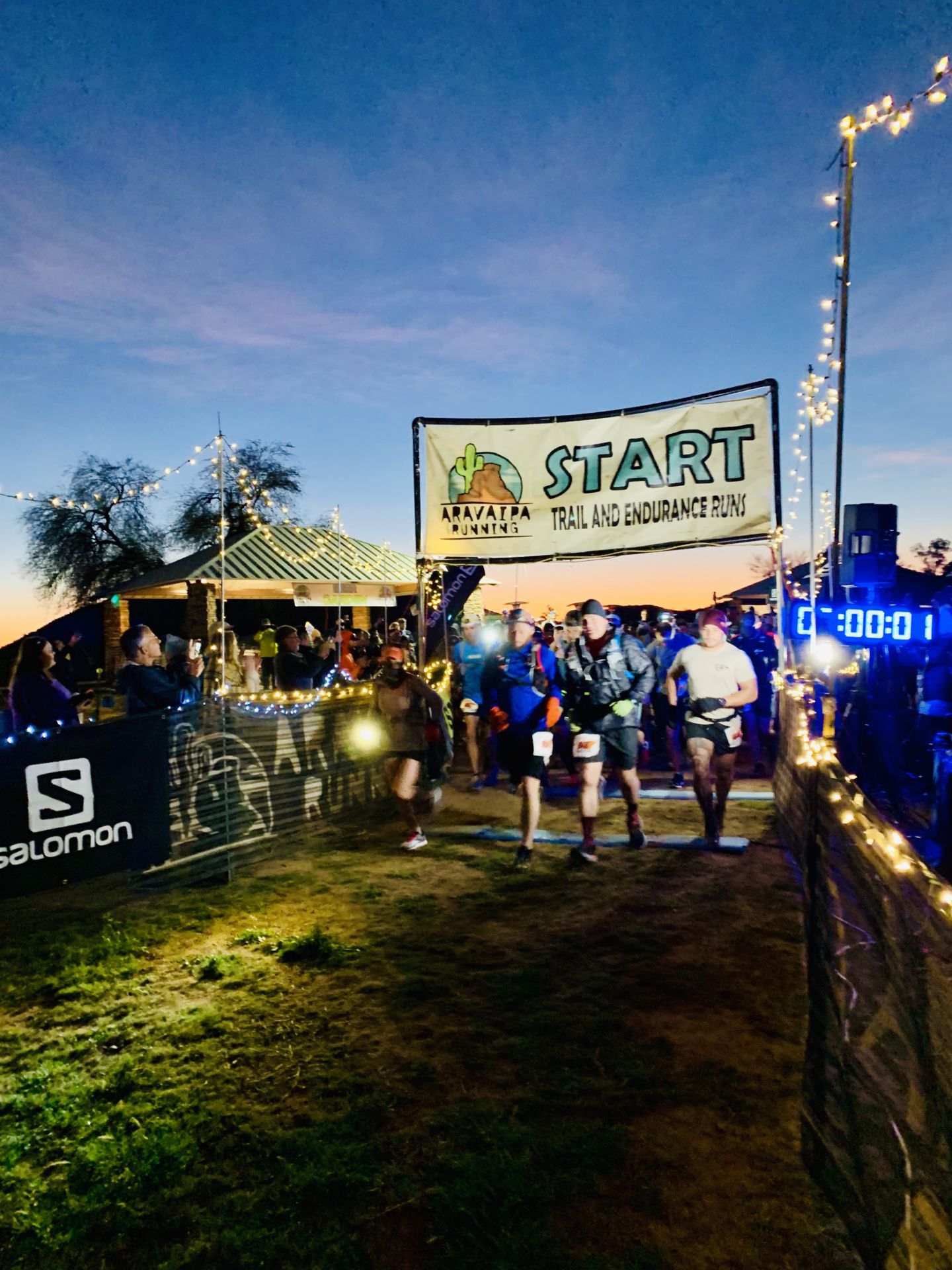
7:00 AM – 100 Mile Start
7:06 AM – Begin civil twilight
7:15 AM – 100K Start
7:30 AM – 60K Start
7:32 AM – Sunrise
8:00 AM – 40K Start
8:30 AM – 10 Mile Start
8:45 AM – 5 Mile Start
5:44 PM – Sunset
6:10 PM – End civil twilight
Sunday, January 21, 2024
7:06 AM – Begin civil twilight
7:31 AM – Sunrise
3:00 PM – Final 100 Mile Cutoff
Park Entry Fee
Remember the park now charges a $7 park entry fee per vehicle. Please arrive early and have correct change (cash) available on race morning for a smooth entry process. Carpool to save!
Trail Running & Trash
Please respect the trails and the beauty of the desert by disposing of any trash at one of our aid stations.
Trail Etiquette
Under no circumstances is it OK to yell at or be rude to a volunteer or staff member. Do not rely on volunteers, photographer’s or other staff persons to direct you on your course. It is YOUR responsibility to know your course and follow the course signs. If we get word of this occurring, we reserve the right to DQ you from the race. These people are volunteering their free time to assist you in reaching the finish line and are doing everything they can to get you there. Thank them and keep moving.
Remember to always remain on designed trails, no short cutting.
If you decide to use headphones, please be respectful of runners behind you attempting to pass. Also, remove ear buds as you approach aid stations or a road crossing.
Please do not listen to music on course without headphones.
Hiking poles are allowed. Please be conscious of where you’re pointing them.
This course includes some legit single track. If you are fast and attempting to pass, please alert the runner in front of you before flying past them. Likewise, if you hear a runner approaching you from behind, attempt to find a spot to allow the runner to pass.
As a general rule, when passing a runner, announce, “on your left.”
Uphill runners/hikers have the right of way to downhill runners. Remain in control as you descend and respect the other runners.
Everyone is after the same goal here so let’s be respectful of each other’s races and have fun. Please.
Photography
To capture both your pain and euphoria along the way, we will staff out on the course. With our crew, you get photographers who are also runners and understand what your race photos mean to you!
Race Timing
We will be utilizing a chip timing system at this event to record your time at the finish. You will be provided with a timing chip attached to the back side of your race bib. It is important to not crease, or fold the the timing chip to ensure your finish time is read. Results after each lap will be displayed on a screen at the finish line turnaround.
We will also be placing remote timing points on the course making it easier for crews, friends, and families to follow you on your journey! To access the live updates, visit this link: live.aravaiparunning.com, on race day and click on Coldwater Rumble.
Aid Station Helpers
We cannot produce these trail runs without the help of our amazing volunteer team. You can even help and run on race day. If you would like to join our volunteer team, we are looking for help with event setup, aid station captains, aid station helpers, timing, photography, videography, social media and event breakdown. Volunteer perks include a piece of Aravaipa merchandise or race goody and Aravaipa Race Credits. You can see our current opportunities and sign up here: Coldwater Rumble Volunteer Form
Course Markings
The race courses will be well marked with orange plastic ribbons with black polka dots as well as orange pin flags with the Aravaipa Running logo on one side. Trail junctions and turns will be well marked with colored laminated. In addition, blue & white checkerboard plastic flagging will be hung to designate non-race or “WRONG WAY” trails. All runners are responsible for understanding the layout of the courses. Please familiarize yourself with the course maps on our website prior to race day and/or print a map to bring along with you.
Parking / Start Area
The 2024 start/finish line is located at the Estrella Mountain Competitive Track. There are plenty of parking spaces within the start/finish area and the surrounding satellite lots.
Camping
Tent & RV sites are available at the Competitive Track next to the start/finish line for $36 for the weekend (Friday and Saturday nights). You may reserve a camping site with your registration this year. There are portable restrooms located at the staging area. Purchase Camping Permit
Tent & Cot Rental
We will be renting tents and cots for use by runners again this year. You may reserve a tent and/or cot when you register for the race. The tent will be setup by 2 p.m. Friday, so all you have to do is bring your own sleeping bag (or rent one of ours)! The tents are all “4 person” 12 ft x 8 ft camping tents. Purchase Tent & Cot Rentals
RESULTS
Live Results
Live Results Link
Course Records
100M | Male – 15:09:52 – Catlow Shipek (’14) | Female – 18:47:02 – Annie Hughes (’22)
52M | Male – 7:21:59 – Nicholas Mamrak (’20) | Female – 7:10:22 – Courtney Dauwalter (’18)
52K | Male – 3:45:12 – Eric Senseman (’19) | Female – 4:31:52 – Nicole Hansen (’22)
20M | Male – 2:11:46 – Charlie Ware (’19) | Female – 2:26:58 – Georgia Porter (’22)
20K | Male – 1:19:17 – Art DeGraw (’19) | Female – 1:31:22 – Haley Wolf (’15)
4M | Male – 27:03 – Jay Jump (’20) | Female – 31:19 – Katherine Weiss (’16)
Previous Distance Course Records
50M | Male – 7:11:13 – Dave James (’13) | Female – 9:39:34 – Magi Redlich (’13)
50K | Male – 3:57:02 – Brendan Halpin (’13) | Female – 4:29:41 – Polly Campbell (’13)
4M (different starting area) | Male – 25:51 – Paul Kramer (’12) | Female – 31:31 – Callie Van O (’12)
Results
2024 | Results
2023 | Results
2022 | Results
2021 | Results
2020 | Results
2019 | Results
2018 | Results
2017 | 100M | 52M | 52K | 20M | 20K | 4M
2016 | 100M | 52M | 52K | 20M | 20K | 4M
2015 | 100M | 52M | 52K | 20M | 20K | 4M
2014 | 100M | 52M | 52K | 20M | 20K | 4M
2013 | 50M | 50K | 31K | 19K | 4M
2012 | 50K | 31K | 19K | 4M
PHOTOS
2024 | Aravaipa Photo Gallery | Let’s Wander Photography
2023 | Aravaipa Photo Gallery
2022 | Aravaipa Photo Gallery | Let’s Wander Photography
2021 | Aravaipa Photo Gallery
2020 | Aravaipa Photo Gallery
2019 | Aravaipa Photo Gallery
2018 | Aravaipa Photo Gallery
2017 | Aravaipa Photo Gallery | SweetM Images
2016 | Aravaipa Photo Gallery | SweetM Images
2015 | Aravaipa Photo Gallery
2014 | Aravaipa Photo Gallery
2013 | Aravaipa Photo Gallery
2012 | Aravaipa Photo Gallery| Michael Miller
2011 | Aravaipa Photo Gallery
VIDEOS
Directions
From central Phoenix, take I-10 west to Estrella Parkway exit. Travel south to Vineyard Ave. Turn east on Vineyard Ave. to the Estrella Mountain Regional Park entrance on the south side.
Address
14805 West Vineyard Avenue
Goodyear, AZ 85338